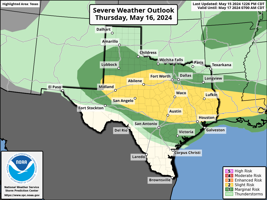
Severe Weather Outlook Outlook Day 2
| Outlook Day 1 | Outlook Day 2 | Outlook Day 3 |

| Severe Thunderstorm Risk Categories | ||
| NWS defines a severe thunderstorm as measured wind gusts to at least 58 MPH, and/or hail to at least one inch in diameter, and/or a tornado. All thunderstorm categories imply lightning and the potential for flooding. Categories are also tied to the probability of a severe weather event within 25 miles of your location. | ||
|
THUNDERSTORMS No Severe Thunderstorms Expected |
Lightning/flooding threats exist with all thunderstorms. |
● Winds to 40 MPH ● Small hail |
|
MARGINAL Isolated Severe Thunderstorms Expected |
Limited in duration and/or coverage and/or intensity. |
● Winds to 40–60 MPH ● Hail up to 1 inch ● Low tornado risk |
|
SLIGHT Scattered Severe Thunderstorms Expected |
Short-lived and/or not widespread, isolated intense storms possible. |
● One or two tornadoes ● Reports of strong winds/wind damage ● Hail approx 1 inch, isolated 2 inch |
|
ENHANCED Numerous Severe Thunderstorms Expected |
More persistent and/or widespread, a few intense. |
● A few tornadoes ● Several reports of wind damage ● Damaging hail, 1-2 inch |
|
MODERATE Widespread Severe Thunderstorms Expected |
Long-lived widespread, and intense. |
● Strong tornadoes ● Widespread wind damage ● Destructive hail, approx 2 inches plus |
|
HIGH Widespread Severe Thunderstorms Expected |
Long-lived, very widespread and particularly intense. |
● Tornado outbreak ● Derecho |


